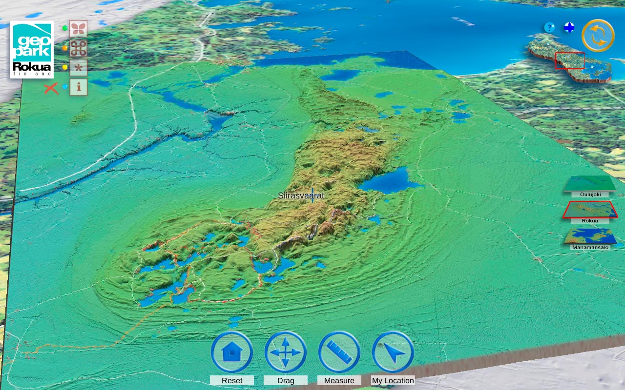
Rokua Geopark 3D map
Rokua Geopark is a tourist destination which has UNESCO Global Geopark status. Rokua Geopark is an unique geological environment. It comprises three different areas, the Oulujoki River Valley, Lake Oulujärvi and Rokua Eskers area. Area's uniqueness and various possibilities are shown in the app that has been created for mobile devices. Rokua Geopark 3D map shows names of the places and user's location on the map.